gis

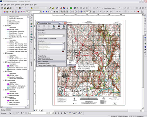
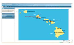
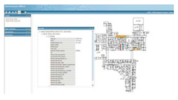
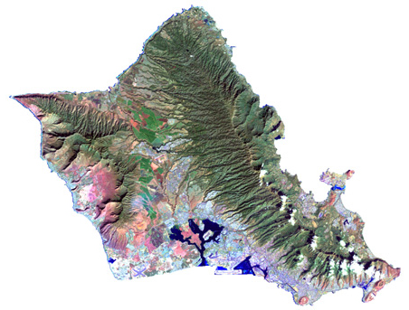
Geographic Information Systems (GIS) is a computer-based tool used in a variety of industries for performing information analysis, automated mapping, and data integration. When used as a result of proper planning and attention to detail, GIS allows the end user to make better decisions quicker, and provides planners, engineers and technicians with the ability to understand and use data that may otherwise be overlooked. GIS combines the best of map making with the best of database management, resulting in a powerful combination of visual and computational analysis.

Internet Mapping is our strategy for communicating and visualizing geographic information over the Internet. The fundamental objectives of Internet Mapping are to provide the products, services, and knowledge that ensure:

  • Users have access to relevant data
  • Clients have an sustainable data platform
  • An easy to use effective tool

Internet Mapping offers a number of turn-key solutions for clients who wish to provide interactive maps online to the end users. We mainly work with clients to develop and deploy sophisticated and easy to manage in-house Internet mapping systems and our cost effective and flexible ArcServer site hosting option is an ideal alternative for many organizations. Implementing a successful Internet mapping application represents a formidable challenge. We have the experience and expertise to ensure a successful Internet mapping product.

Government: Nearly every feature of interest to government – roads, political jurisdictions, population, zoning, property lines, utilities, growth and planning – can utilize GIS to be inventoried, viewed and cross-related in new ways that improve decision making.

Municipalities: HIES develops stand-alone applications for each department while coordinating with all departments to build a single repository for data, thus saving time, money, and duplication.

Law Enforcement: HIES develops mapping and reporting mechanisms which facilitate crime analysis and prevention. Administrative and policy decisions can be targeted to focus on specific needs.

Department of Health: HIES utilizes GIS for better health care services management. Distribution patterns of people, care centers and health concerns are analyzed to isolate and fix problems. GIS is also used to locate/record assets and personnel within the organizational division such as HR, Engineering, Administration, and Support.

Emergency Evacuation: HIES maps all routes of evacuation and develops a network based on various thresholds and type and location of disaster.

Engineering Drawings alone are no longer a sufficient format to manage large scale complex project data. GIS provides a centralized and organized data store that may be distributed quickly, efficiently and digitally to reduce project costs and duration.

Field Services: HIES can provide field personnel with access to enterprise data and maps which can be easily updated while they are in the field, giving you the latest data now.

Survey: HIES uses the precision of GPS to assist in all types of survey projects including utilities, mapping, and real estate planning.

Business: Understanding the geography of businesses and markets is crucial for creating competitive advantages, marketing with results, and making strategic decisions

Site Selection: HIES uses demographic and infrastructure data in time series modeling to show current conditions as well as to predict future trends.

Marketing: A thorough knowledge of your customers will provide opportunities for upward and cross selling campaigns, better responses to loyalty programs and promotions, and more precise prospecting.

HIES is committed to providing comprehensive decision making products and services. HIES can assist almost any organization develop its use and implementation of GIS. Our process for managing technologically complex projects ensures delivery of high-value, low-risk solutions for clients.Our quality project management allows clients to focus on their core business issues while we manage their projects from inception to completion.

  • Needs Assessment & Consultation
  • Data Collection
  • Map Production using PLTS
  • ArcGIS Server Website Hosting
  • ArcIMS Services
  • CADD to GIS Conversions
  • Design & Development GIS Systems
  • Data Digitization and Conversion
  • Data Migration and Integration
  • GIS Analysis Modeling
  • Internet Mapping
  • Aerial Photo / Photogrammetry
  • GPS Location Verification
  • Cartographic Output
  • Support
  • Training

Environmental
GIS is used for a variety of applications ranging from simple inventory and query, to map analysis and overlay, and complex spatial decision-making systems.

Environmental Impact
Studies: HIES develops interactive GIS databases and models illustrating the design/development risk and impact. We examine the data from various perspectives, timeframes, and events, and compare it to historic site ownership, operations and other factors pertinent to the study.

Conservation and Management: 
HIES provides GIS mapping, analysis, custom programming and consulting services spanning all aspects of site management, monitoring, characterization, remediation design, cleanup, regulatory reporting, facility and asset management, redevelopment
planning, and decision support.

INDUSTRIES
Government
Utilities
Business
Environmental
Engineering

PARTNERS
PASCO
BAE Systems
Shaw Group

OFFICES
Kailua, Hawaii
Kawasaki, Japan
Parker, Colorado

Scroll to Top